

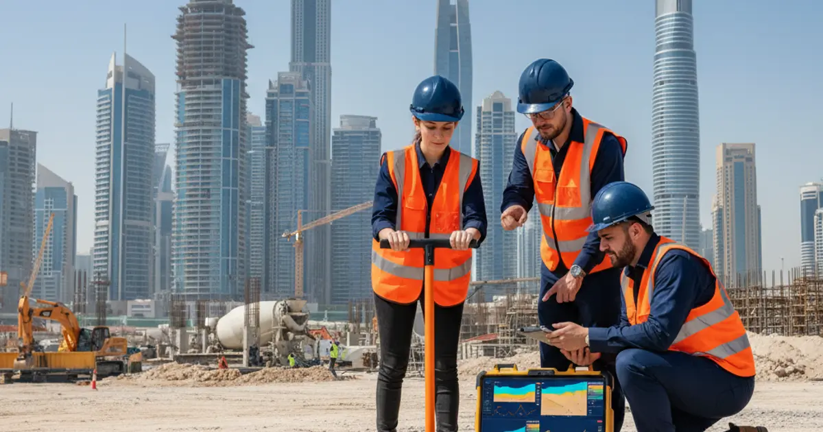
Before any foundation is laid in Dubai, understanding what lies beneath the surface is critical. A geophysical survey in Dubai gives engineers and developers a non-invasive, data-rich view of subsurface conditions, enabling smarter planning and safer construction. Whether you are working on a high-rise, an infrastructure corridor, or an industrial facility, subsurface uncertainty is a serious risk. This blog explains what geophysical surveys involve, why they matter for projects in the UAE, and how combining them with other geotechnical services produces the most reliable results.
Key Takeaways
- A geophysical survey Dubai helps identify subsurface hazards such as cavities, weak zones, and buried utilities before construction begins.
- Combining geophysical surveys with borehole drilling Dubai and land survey Dubai services produces a comprehensive picture of site conditions.
- EIAC-accredited geotechnical investigation supports regulatory compliance and engineering confidence across UAE projects.
What Is a Geophysical Survey and Why Does It Matter in Dubai?
A geophysical survey is a scientific investigation method that uses physical measurements taken at or near the ground surface to map subsurface conditions. Common techniques include seismic refraction, ground-penetrating radar (GPR), electrical resistivity tomography (ERT), and microgravity surveys. Each method sends energy into the ground and records how it travels or reflects back, generating data that specialists interpret to identify soil layers, rock formations, voids, water tables, and anomalies.
In Dubai, the ground is not always what it appears. The region features complex geological conditions including soft coastal sediments, sabkha zones with high salinity, gypsum-bearing soils prone to dissolution, and highly variable rock competency. According to the United States Geological Survey, subsurface mapping before construction dramatically reduces the risk of unexpected ground movement, settlement, or structural instability. These risks are especially relevant in the UAE, where rapid urban development frequently encounters challenging ground conditions.
A well-executed geophysical survey Dubai is not merely a preliminary formality. It is a foundational investment that protects project timelines, budgets, and long-term structural integrity.
Key Geophysical Survey Techniques Used on UAE Construction Sites
Different project types require different investigation methods. Understanding which technique applies to your site ensures accurate, actionable data.
- Ground-Penetrating Radar (GPR): Ideal for detecting buried utilities, voids, rebar positioning, and shallow subsurface features. Widely used in urban Dubai where underground infrastructure is dense.
- Electrical Resistivity Tomography (ERT): Maps variations in soil and rock resistivity to identify groundwater, contamination, or dissolution features in gypsum-rich soils.
- Seismic Refraction and MASW: Measures seismic wave velocities to determine soil stiffness, layer depths, and rock profiles, which is valuable for foundation design and liquefaction assessment.
- Microgravity Surveys: Detects subsurface voids and caves, which is particularly relevant in carbonate rock terrains present in parts of the UAE.
- Borehole Geophysics: Integrates in-hole logging with surface surveys to validate findings and improve subsurface models.
Selecting the right combination of methods depends on the project scale, ground type, and depth of investigation required. A competent geotechnical team will assess these factors and recommend the most cost-effective approach.
How Geophysical Surveys Complement Borehole Drilling and Land Surveying
Geophysical surveys are most powerful when used alongside other site investigation methods. They cover large areas quickly and non-invasively, but borehole drilling provides the point-specific physical samples and in-situ test data needed to validate geophysical interpretations.
Terrasearch Gulf provides integrated geotechnical investigation services that combine surface-based geophysical methods with traditional drilling and sampling. Borehole drilling Dubai services allow engineers to collect soil and rock cores at precise locations flagged by geophysical anomalies, confirming the nature of any subsurface feature identified remotely. This integrated approach eliminates the guesswork that comes from relying on a single investigation method.
Similarly, land survey Dubai services establish the spatial framework for any site investigation. Accurate topographic and boundary data ensures that geophysical traverses are correctly georeferenced, that borehole locations are precisely positioned, and that all investigation data can be reliably mapped onto design drawings. Without an accurate land survey, subsurface data loses much of its engineering value.
The three disciplines work together as a system. Geophysical surveys identify zones of interest across the full site. Borehole drilling targets those zones for physical verification. Land survey services anchor everything to accurate coordinates. Together, they form a complete picture of site conditions that engineering teams can rely on.
Regulatory Compliance and EIAC Accreditation in Dubai
Construction in Dubai operates within a rigorous regulatory environment. Authorities including the Dubai Municipality, the Roads and Transport Authority (RTA), and various free zone regulators require geotechnical investigation reports that meet defined standards. Data quality, laboratory testing accuracy, and reporting methodology are all subject to scrutiny.
Terrasearch Gulf is an EIAC-accredited testing laboratory, which means its investigation and testing outputs meet the standards set by the Emirates International Accreditation Centre. This accreditation is not cosmetic. It signals that sampling procedures, soil analysis protocols, and reporting formats have been independently audited and verified. For project consultants, contractors, and developers, using an EIAC-accredited provider reduces the risk of data rejection during regulatory review and strengthens the engineering basis for design decisions.
When a geophysical survey Dubai is conducted in conjunction with accredited laboratory testing, the entire investigation chain gains credibility. Soil samples retrieved from boreholes are tested under controlled, accredited conditions. Results are reported with traceability. This matters enormously when submitting ground investigation reports to regulatory bodies or securing project approvals from clients and lenders.
When Should You Commission a Geophysical Survey in Dubai?
Many project teams underestimate the value of early-stage geophysical investigation. The most common point of commissioning should be before detailed design begins, but there are several scenarios where a geophysical survey adds particular value.
- Greenfield developments: Sites with no prior investigation history benefit most from a broad geophysical sweep before borehole planning.
- Sites near sabkha or coastal zones: Geophysical methods can map the lateral extent of problematic ground without the cost of extensive drilling grids.
- Infrastructure corridors: Roads, pipelines, and utility routes covering long distances are difficult to investigate with drilling alone. Seismic or resistivity profiling provides continuous subsurface coverage efficiently.
- Forensic investigations: When buildings or pavements show unexpected settlement or cracking, geophysical surveys help locate the cause without disruptive excavation.
- Sites with suspected buried structures or utilities: GPR surveys protect workers and equipment during subsequent drilling or excavation by locating hazards in advance.
Commissioning a geophysical survey early in the project lifecycle consistently saves time and money by narrowing the scope of physical investigation and reducing the risk of design changes during construction.
Conclusion
A geophysical survey in Dubai is not a luxury reserved for large-scale infrastructure projects. It is a practical, cost-effective tool that helps any construction team understand what lies beneath their site before committing to foundation design, earthworks, or utility installation. When paired with borehole drilling Dubai services for physical verification and land survey Dubai services for spatial accuracy, geophysical investigation delivers the most complete and reliable subsurface picture available. For projects in the UAE, where ground conditions can be unpredictable and regulatory standards are stringent, this integrated approach is simply the smarter way to plan. To learn more about how Terrasearch Gulf supports site investigation across Dubai and the wider UAE, visit their geotechnical investigation services page and speak with their accredited team today.
Frequently Asked Questions
What is a geophysical survey in Dubai used for?
A geophysical survey in Dubai is used to map subsurface soil layers, detect voids, locate buried utilities, and identify problem zones before construction begins. It reduces uncertainty and supports safer, more informed foundation and infrastructure design decisions.
How does a geophysical survey differ from borehole drilling?
A geophysical survey covers large areas non-invasively using physical wave or signal measurements. Borehole drilling provides physical soil samples at specific points. Both methods complement each other to deliver a complete, verified picture of subsurface conditions on any project site.
What geophysical methods are commonly used in the UAE?
Common methods include ground-penetrating radar, electrical resistivity tomography, seismic refraction, MASW profiling, and microgravity surveys. The right method depends on ground type, project depth requirements, and the specific subsurface features that need to be identified on site.
Why is EIAC accreditation important for geotechnical investigation?
EIAC accreditation confirms that testing and investigation procedures meet independently audited standards. This ensures data quality, supports regulatory submissions in Dubai, and gives clients and engineers confidence in the accuracy of all ground investigation results and reports.
When is the best time to commission a geophysical survey?
The best time is before detailed design begins. Early-stage geophysical investigation reduces borehole costs, informs foundation selection, and prevents costly design changes during construction. It is particularly valuable for greenfield sites, coastal zones, and long infrastructure corridors.
Can a geophysical survey detect gypsum dissolution in Dubai soils?
Yes. Electrical resistivity tomography and microgravity methods can identify areas where gypsum-bearing soils have dissolved, forming voids or weak zones. This is especially relevant in parts of Dubai and the UAE where carbonate and gypsum-rich geological formations are present.
How does a land survey support a geophysical investigation?
A land survey provides precise spatial coordinates and topographic data that anchor geophysical traverses and borehole positions to accurate site maps. Without reliable positional data, subsurface findings cannot be reliably integrated into engineering drawings or geotechnical investigation design models.
Is a geophysical survey required by Dubai Municipality?
Regulatory requirements vary by project type and location. However, Dubai Municipality and other UAE authorities typically require comprehensive geotechnical investigation reports. Including geophysical survey data strengthens these reports and supports faster regulatory review and approval processes.
How long does a geophysical survey typically take in Dubai?
Duration depends on site size, access conditions, and the methods chosen. A focused GPR scan of a building footprint may take one day. A multi-method investigation of a large infrastructure corridor could take several days to a few weeks including data processing and reporting.
What types of projects benefit most from geophysical surveys in the UAE?
High-rise developments, road and utility corridors, waterfront projects, industrial facilities, and forensic investigations of distressed structures all benefit significantly. Learn more about integrated services at Terrasearch Gulf for projects where ground-related risks could impact cost, schedule, or safety.