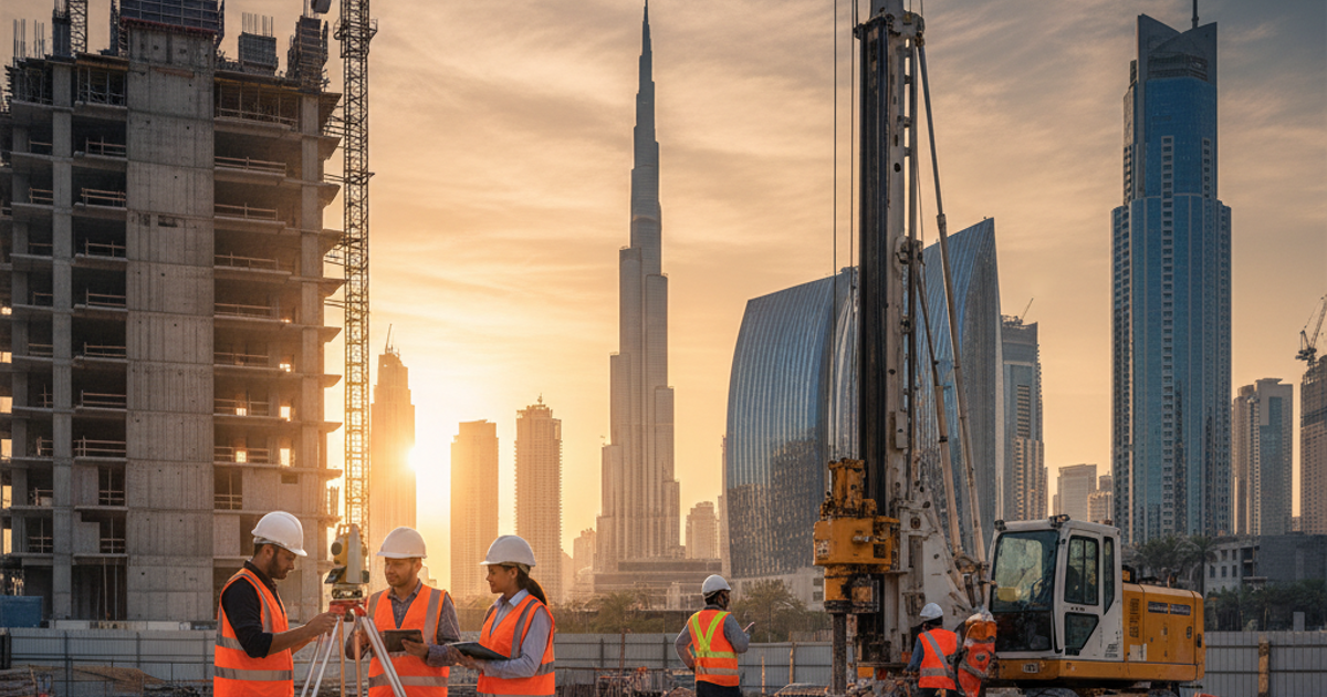

Land survey in Dubai is far more than a regulatory formality. It is the technical backbone that determines whether a construction or infrastructure project succeeds or fails. Before a single foundation is poured or a structural column is erected, engineers and developers need precise, verified data about the ground beneath their feet. In a city like Dubai, where ambitious projects rise on varied and complex terrain, skipping or underestimating this step carries serious consequences for safety, cost, and compliance.
Key Takeaways
- A thorough land survey Dubai provides critical subsurface data that drives every major design and engineering decision on a project.
- Geophysical survey Dubai techniques reveal hidden ground anomalies, void spaces, and soil layer variations before construction begins.
- Borehole drilling Dubai delivers direct, laboratory-verifiable soil and rock samples that support accurate foundation design and structural planning.
- Working with an EIAC-accredited laboratory ensures your site investigation data meets UAE regulatory standards and project specifications.
What a Land Survey in Dubai Actually Involves
A land survey is a structured technical process that examines the surface and subsurface conditions of a site before any design or construction work begins. It involves collecting measurable, verifiable data about soil composition, ground stability, underground features, and topographic conditions. This information is then analyzed to inform foundation design, drainage planning, and load-bearing calculations.
In Dubai specifically, ground conditions can vary dramatically across short distances. Sabkha deposits, loose sand layers, and subsurface cavities are common in various parts of the emirate. Without a proper land survey Dubai professionals trust and rely on, engineers risk designing foundations that are mismatched with actual ground conditions. This mismatch can lead to differential settlement, structural cracking, or costly remediation work during or after construction.
According to the Dubai Municipality, site investigation and geotechnical assessments are mandatory components of the building permit process. This regulatory requirement underscores how critical accurate ground data is before any project moves forward.
The Role of Geophysical Survey in Site Assessment
A geophysical survey Dubai teams deploy is a non-invasive investigation method that uses physical signals to map subsurface conditions without excavation. Common techniques include seismic refraction, ground-penetrating radar, and electrical resistivity testing. These methods detect variations in soil density, moisture content, and material composition across large areas quickly and cost-effectively.
Geophysical surveys are particularly valuable in early project stages when engineers need a broad picture of site conditions before committing to more targeted and expensive investigation methods. For example, a ground-penetrating radar survey can reveal buried utilities, void spaces, or soft soil zones that would otherwise remain hidden until construction equipment encounters them. Identifying these risks early allows design teams to adjust foundation strategies, route service lines safely, and avoid expensive mid-project changes.
When combined with physical sampling methods, a geophysical survey significantly improves the accuracy of the overall site investigation. The data collected supports better risk assessment and gives project managers and consultants the confidence to proceed with informed decisions.
Why Borehole Drilling Is Essential for Foundation Design
While geophysical surveys provide a broad subsurface picture, borehole drilling Dubai engineers and geotechnical specialists conduct gives direct physical access to subsurface materials. A borehole is a vertical or angled hole drilled into the ground to retrieve soil and rock samples at various depths. These samples are then tested in an accredited laboratory to determine load-bearing capacity, shear strength, compressibility, and chemical composition.
Borehole data is indispensable for foundation design. Engineers use it to determine the appropriate type of foundation, whether shallow strip foundations, raft foundations, or deep pile foundations are required. Without borehole results, these decisions are based on assumptions rather than verified data, which introduces unacceptable risk into the project.
In Dubai, where projects often involve high-rise towers or large-scale infrastructure, the depth and spacing of boreholes must be carefully planned. Geotechnical engineers typically follow international standards and local guidelines to determine how many boreholes are required and at what depths samples must be retrieved. Laboratory testing of those samples, conducted by an accredited facility, transforms raw material into reliable engineering data.
Site Investigation and Soil Analysis: Connecting Field Data to Design
Site investigation is the broader process that ties together all field and laboratory activities. It encompasses the planning, execution, and reporting of all ground investigation work, including surveys, drilling, sampling, and testing. The final geotechnical report produced from this process becomes a foundational document that engineers, consultants, and regulatory reviewers rely on throughout the project lifecycle.
Soil analysis is a core component of this process. Laboratory tests determine critical soil properties such as particle size distribution, Atterberg limits, consolidation characteristics, and California Bearing Ratio values. These results directly influence pavement design, retaining wall specifications, slope stability analysis, and drainage system planning. Projects that skip detailed soil analysis often encounter performance problems that are expensive to fix after construction is complete.
Terrasearch Gulf provides comprehensive geotechnical investigation services that cover the full range of site investigation requirements. As an EIAC-accredited testing laboratory, the company delivers results that meet the technical and regulatory expectations of clients across Dubai’s construction and infrastructure sectors.
How Accurate Site Assessment Protects Your Project Investment
An accurate site assessment is not simply a compliance exercise. It is a financial protection tool. When ground conditions are well understood before design begins, engineers can optimize foundation systems to avoid over-engineering or under-engineering. Both errors are costly. Over-engineered foundations waste materials and budget. Under-engineered foundations create safety risks and require remediation.
Consider a commercial development scenario in Dubai where poor site assessment missed a layer of compressible fill beneath the planned building footprint. Without that information, the foundation design would be inadequate, and post-construction settlement could damage finishes, utilities, and structural elements. The cost of rectification in such cases routinely exceeds the original cost of a thorough site investigation by a significant margin.
Early investment in a reliable land survey Dubai professionals conduct pays dividends across the entire project timeline. It reduces design revisions, minimizes unexpected ground-related delays, and supports smoother approval processes with regulatory authorities. For developers and contractors in Dubai, accurate ground data is one of the most cost-effective investments available at the project planning stage.
Choosing the Right Testing Partner for Your Site Investigation
Not all testing providers deliver the same quality of data. For a site investigation to be credible and regulatory-compliant in the UAE, it must be conducted and reported by a qualified, accredited organization. EIAC accreditation is the benchmark in the UAE for laboratory testing quality and competence. It signals that the laboratory follows internationally recognized testing standards and maintains rigorous quality control over its processes and results.
Terrasearch Gulf is an EIAC-accredited testing laboratory in Dubai that provides geotechnical investigation, soil analysis, borehole drilling support, and construction material testing. The company supports construction companies, civil engineering firms, real estate developers, and infrastructure contractors with technical services that are accurate, compliant, and project-specific. Partnering with an accredited laboratory means your site investigation data will hold up to scrutiny from engineers, consultants, and regulatory reviewers alike.
Conclusion
Every successful construction project in Dubai is built on a foundation of accurate, verified ground data. A comprehensive land survey Dubai professionals rely on, combined with geophysical surveying, borehole drilling, and detailed soil analysis, gives engineers the information they need to design safely, efficiently, and in full compliance with local regulations. Skipping or shortcutting this process introduces risks that no responsible developer or contractor should accept. If your project is in the planning or early design phase, now is the right time to commission a thorough site investigation from a trusted, EIAC-accredited partner. Contact Terrasearch Gulf to discuss your site investigation and geotechnical testing requirements today
Frequently Asked Questions
What is a land survey in Dubai and why is it required?
A land survey in Dubai is a technical assessment of surface and subsurface ground conditions conducted before construction. It is required by Dubai Municipality as part of the building permit process to ensure foundation designs are based on verified, accurate ground data.
What does a geophysical survey in Dubai involve?
A geophysical survey in Dubai uses non-invasive techniques such as ground-penetrating radar, seismic refraction, and electrical resistivity testing to map subsurface conditions. It identifies hidden voids, buried utilities, and variable soil layers without the need for excavation or drilling.
How deep do boreholes go during a site investigation in Dubai?
Borehole depth depends on the project type and anticipated foundation depth. For high-rise structures, boreholes can extend 30 to 60 meters or deeper. Geotechnical engineers determine depth requirements based on project load conditions and applicable investigation standards.
Why is EIAC accreditation important for a testing laboratory in Dubai?
EIAC accreditation confirms that a laboratory meets internationally recognized standards for technical competence and quality management. In the UAE, regulatory authorities and project consultants require accredited test results to validate geotechnical investigations, material testing, and construction compliance reports.
What soil types are commonly found in Dubai that affect construction?
Dubai’s ground frequently contains sabkha, a salt-bearing, highly compressible marine deposit, as well as loose aeolian sand and calcarenite rock. These conditions can significantly affect settlement behavior, foundation design choices, and construction material specifications for any new project.
How does borehole drilling support foundation design decisions?
Borehole drilling and geotechnical investigation services provide direct soil and rock samples that laboratories test for load-bearing capacity, shear strength, and compressibility. These results allow engineers to select the correct foundation type and depth, reducing risk and ensuring structural safety throughout the project lifecycle.
Can a geophysical survey replace borehole drilling on a project?
No. A geophysical survey provides broad subsurface mapping but cannot replace the physical sampling that borehole drilling delivers. Both methods are complementary. Surveys guide drilling locations while boreholes provide verifiable material data that geophysical readings alone cannot confirm with sufficient engineering accuracy.
How many boreholes are typically needed for a construction site in Dubai?
The number of boreholes depends on site size, project type, and ground variability. Geotechnical engineers follow local guidelines and international standards such as Eurocode 7 to determine borehole spacing. Larger or more complex sites require a greater number of boreholes to provide representative subsurface data.
What happens if site investigation data is inaccurate or incomplete?
Inaccurate site investigation data can lead to foundation designs that are poorly matched to actual ground conditions. This may cause differential settlement, structural cracking, or costly mid-project remediation. Incomplete data also creates risk of regulatory non-compliance, project delays, and significant additional expense for developers and contractors.
How can Terrasearch Gulf support my site investigation in Dubai?
Terrasearch Gulf soil testing and analysis services are delivered by an EIAC-accredited laboratory in Dubai covering geotechnical investigation, borehole drilling support, and construction material testing. The company delivers accurate, compliant results that meet UAE regulatory requirements and support informed engineering decisions for construction and infrastructure projects.