

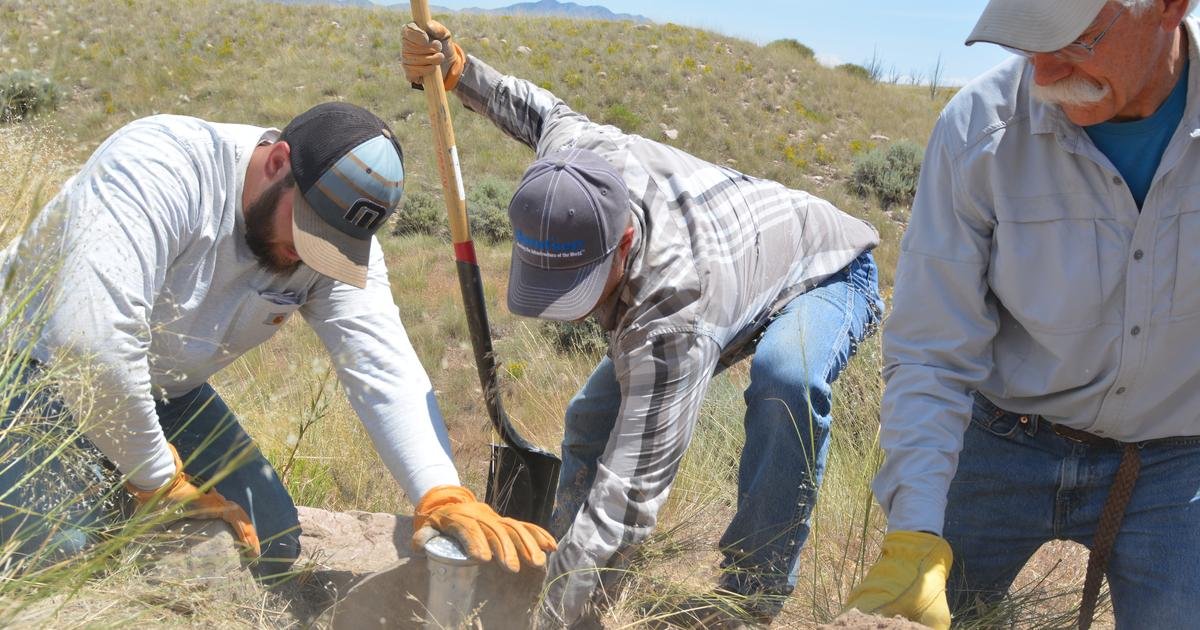
Every successful construction project in the UAE begins with an accurate picture of the land. A topographic survey uae developers and consulting engineers rely on captures ground elevation, existing features, and property boundaries before a single design drawing is produced. Without this baseline data, site planning, drainage design, and earthwork volume calculations rest on guesswork rather than fact. Terrasearch Gulf Soil Testing carries out topographic surveys across Dubai and the wider UAE, giving project teams the mapped foundation they need before construction begins.
Key Takeaways
- A topographic survey maps what is on and above the ground surface, distinct from a geophysical survey that maps what lies below it.
- UAE developers use topographic data for site planning, drainage design, and earthwork volume calculations early in a geotechnical investigation project timeline.
- Deliverables typically include contour maps, topographic drawings, and coordinated survey data ready for design teams.
What Is a Topographic Survey UAE Projects Rely On
A topographic survey uae recorded before design work begins gives engineers a clear picture of a site as it exists today, capturing ground shape, features, and boundaries in one coordinated dataset that becomes the reference point for every later stage of a project.
A topographic survey is a structured record of a site’s natural and built features, positioned against a common set of coordinates and elevations. Surveyors visit the site, capture ground shape, existing structures, vegetation, roads, and utility markers, then translate that field data into a scaled map.
In the UAE, this step usually happens right after site acquisition and before architectural or civil design work starts. Consulting engineers use the resulting topographic survey drawings to understand slope, access, and constraints on the plot, which shapes every later decision about layout, drainage, and the wider geotechnical investigation services that follow.
Local authorities across Dubai and other emirates often require an up to date topographic survey as part of the building permit submission package. Outdated or inaccurate data at this stage can delay approvals, since municipal reviewers check that proposed structures align with actual site levels, setback lines, and existing infrastructure records. Working with a licensed survey provider from the outset also reduces the chance of discrepancies surfacing later, when structural or drainage designs are already advanced and changes become far more expensive to make.
Site Mapping Construction Teams Need Before Design Begins
Site mapping construction professionals depend on connects raw ground data to real design decisions, feeding directly into layout planning, drainage routing, and the volume calculations that determine how much cut and fill a project will require.
A topographic survey does far more than produce a contour map on its own. Civil engineers use the elevation data to route stormwater drainage away from structures and toward approved discharge points, a critical requirement across low lying areas identified through prior soil investigation work in the UAE.
Quantity surveyors use the same dataset to calculate earthwork volumes, comparing existing ground levels against proposed finished levels to estimate how much material must be cut or filled before construction materials testing even begins. Architects rely on the survey to confirm setbacks, plot boundaries, and any existing site constraints before finalizing a design, reducing the risk of costly changes once building work is underway, a lesson explored further in why soil testing supports infrastructure development across the region.
Drainage design carries particular weight in coastal and low lying parts of the UAE, where heavy seasonal rainfall can overwhelm sites that were not graded correctly at the planning stage. A topographic survey identifies natural low points and flow paths across a plot, allowing engineers to route stormwater systems before foundations are poured rather than retrofitting drainage after problems appear. The same elevation data also helps quantity surveyors flag sites where extensive fill will be needed, giving developers an early and realistic view of earthworks costs.
Elevation Survey Dubai: Equipment and Field Methods
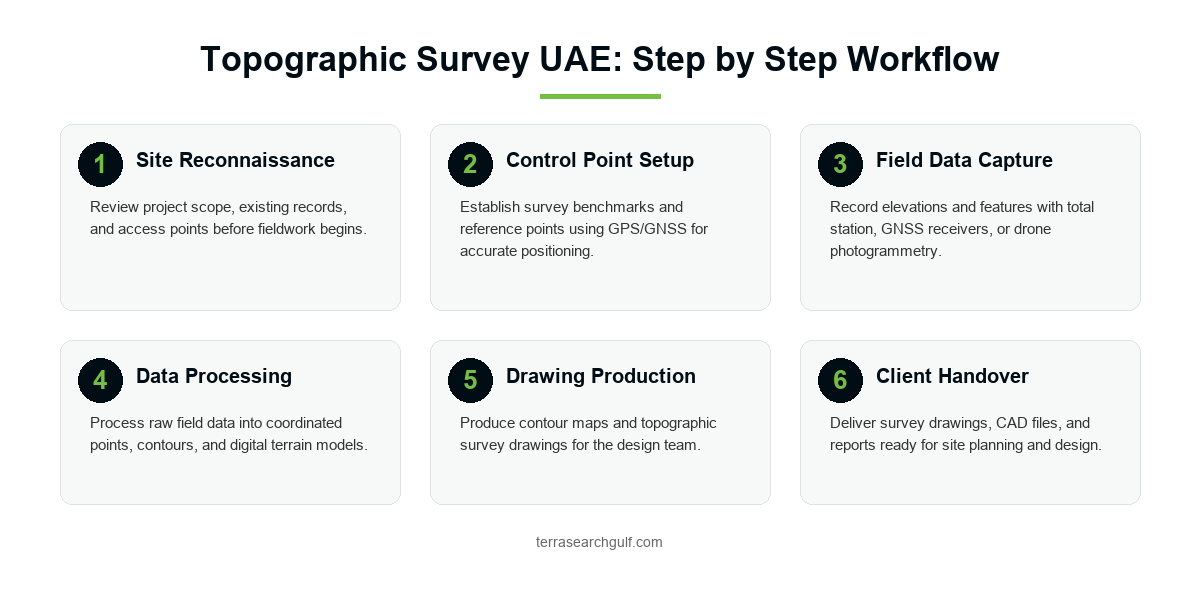
An elevation survey dubai sites require blends traditional and modern instruments, with the choice of equipment shaped by site size, terrain complexity, and how quickly a project team needs finished data.
Field survey teams use a combination of instruments depending on the site. A total station remains the standard tool for precise point by point measurement of elevation and position, a core technique in modern land surveying, particularly on smaller or more complex urban plots covered by survey services teams.
GPS and GNSS receivers allow surveyors to establish control points and cover larger areas quickly by connecting to satellite positioning networks, an approach also used across professional soil investigation companies for large scale UAE projects. On expansive sites, drone assisted survey methods capture thousands of data points through aerial photography, producing detailed terrain models in a fraction of the time a ground based survey alone would take.
Terrasearch Gulf Soil Testing selects the right combination of methods for each project, drawing on the same accredited field standards applied across its third party testing work.
Choosing between these methods usually comes down to project scale and budget. A single plot in an established neighborhood may only need a short total station survey completed in a day. A large master planned development, by contrast, benefits from drone assisted mapping that covers hundreds of hectares in a single flight, then hands off precise ground control points captured by GNSS receivers for accuracy checks. Terrasearch field teams recommend the right mix after an initial site review.
Land Survey UAE Deliverables: Contour Maps and Drawings
A land survey uae clients receive from Terrasearch is handed over as a set of usable documents, not raw field notes, so design teams can move straight into planning without reprocessing survey data themselves.
Once field data is captured, it is processed into a set of deliverables the design team can use directly. Contour maps show elevation changes across the site at set intervals, making slope and drainage patterns easy to read at a glance. Topographic survey drawings present boundaries, existing features, and levels in CAD format, ready to be imported into architectural and civil engineering design software.
Clients typically also receive a written survey report summarizing methodology, control points, and any site constraints identified during fieldwork, similar in structure to the reporting used across geotechnical laboratory testing in the UAE. These deliverables give consulting engineers a single, verified source of site data to build a design around, supported where needed by material testing laboratory results for the same project.
Digital deliverables matter as much as the printed drawings. Most consulting engineers now request topographic data in common CAD and GIS formats so it can be layered directly against architectural and drainage plans without redrawing. Terrasearch structures every land survey uae deliverable this way, giving design teams a file set that plugs straight into existing project workflows rather than a static file that has to be traced or redigitized before use.
Topographic Survey vs Subsurface Geophysical Survey
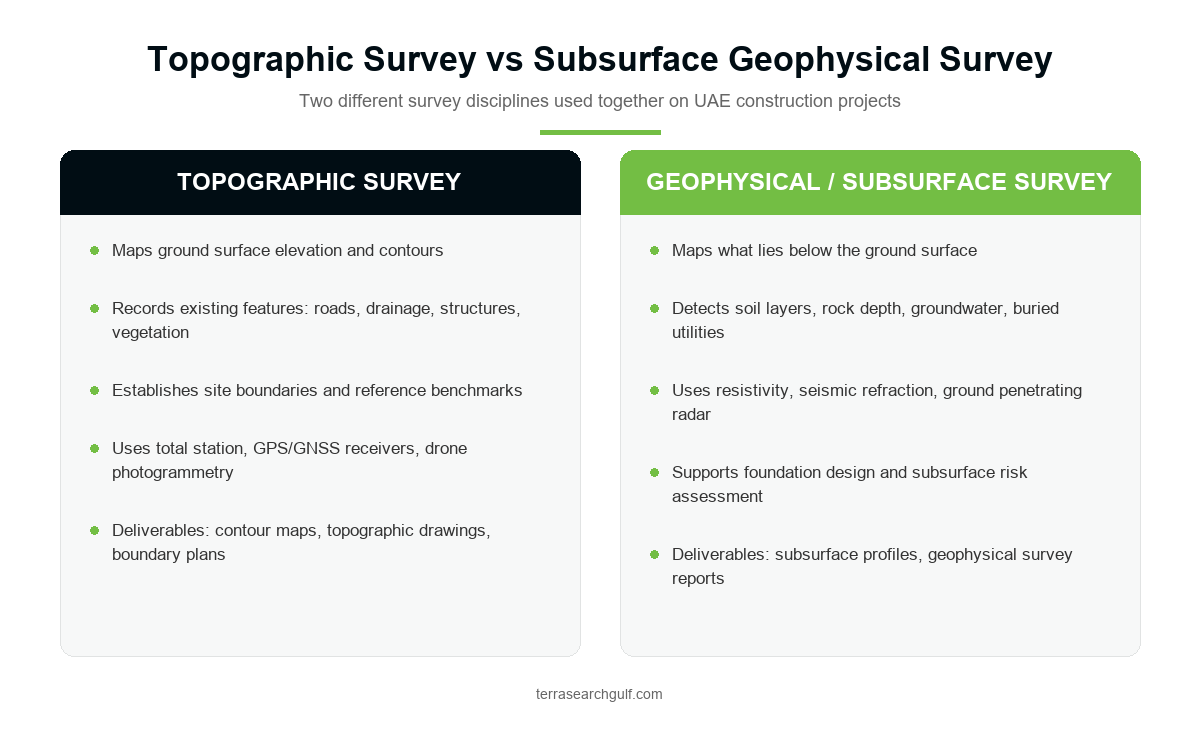
A topographic survey and a geophysical survey answer different questions about the same site, and understanding that difference helps project teams commission the right investigation at the right stage.
A topographic survey maps what is visible on the ground: elevation, features, and boundaries. A geophysical survey, by contrast, investigates what lies beneath the surface, using methods like resistivity testing and ground penetrating radar to identify soil layers, rock depth, groundwater, and buried utilities.
Most UAE projects benefit from both, usually starting with a topographic survey for site planning and later commissioning a geophysical investigation to support foundation design. Terrasearch Gulf Soil Testing offers both services, and clients can read more about how a geophysical survey supports safe and reliable construction in a separate detailed guide.
Commissioning both surveys early, rather than treating them as sequential afterthoughts, gives a project team the fullest possible picture of a site. Topographic data confirms what can be built and where, while geophysical and geotechnical data confirms what the ground can safely support. Together they reduce the number of surprises that surface once excavation and foundation work are underway, which is why most experienced UAE developers request both as standard practice.
Conclusion
A topographic survey uae project teams commission early sets the foundation for every design decision that follows, from drainage routing to earthwork volume calculations. Skipping this step, or relying on outdated data, increases the risk of costly redesigns once construction begins. Terrasearch Gulf Soil Testing provides accredited topographic and land surveys across Dubai and the wider UAE, using total station, GPS, GNSS, and drone assisted methods matched to each site. Contact Terrasearch Gulf Soil Testing today to schedule a topographic survey and get accurate, design ready site data before you build.
Frequently Asked Questions
1. What is a topographic survey uae engineers use before construction?
A topographic survey uae consulting engineers use is a mapped record of ground elevation, existing features, and site boundaries. It gives design teams the baseline data needed for site planning, drainage design, and earthwork calculations before construction begins.
2. How is a topographic survey different from a geophysical survey?
A topographic survey maps what is visible on the ground surface, including elevation and features. A geophysical survey investigates what lies below ground, such as soil layers, rock depth, and buried utilities.
3. What equipment is used for a topographic survey dubai sites require?
Field teams typically use a total station for precise point measurement, GPS or GNSS receivers for control points across larger areas, and drone assisted photogrammetry for fast, detailed terrain mapping on expansive sites.
4. Why do UAE developers need a land survey uae before design work starts?
A land survey uae developers commission early confirms boundaries, elevation, and existing site conditions. This data prevents costly design changes later and supports accurate site planning, drainage routing, and earthwork volume estimates.
5. What deliverables come from a topographic survey?
Clients typically receive contour maps showing elevation changes, CAD format topographic survey drawings, and a written report summarizing methodology and site conditions, ready for use by architects and civil engineers.
6. How long does an elevation survey dubai project usually take?
Timelines depend on site size and terrain complexity. Smaller plots surveyed with a total station may take a few days, while larger sites using drone assisted methods can be completed just as quickly.
7. Is drone survey accurate enough for construction planning?
Yes. Drone assisted survey methods capture thousands of data points across a site, producing detailed terrain models that meet the accuracy needed for site planning, drainage design, and earthwork volume calculations.
8. When should site mapping construction teams commission a topographic survey?
Site mapping construction teams should commission a topographic survey immediately after acquiring a plot, before architectural or civil design begins, so the design is based on accurate, current site conditions.
9. Can Terrasearch provide both topographic and geophysical surveys?
Yes. Terrasearch Gulf Soil Testing offers both survey services in the UAE, allowing project teams to commission ground mapping and subsurface investigation together with construction testing lab support at the appropriate project stage.
10. What survey services uae clients rely on does Terrasearch offer?
Terrasearch Gulf Soil Testing provides topographic surveys, land surveys, and geotechnical investigation services across Dubai and the UAE, supported by accredited field teams and modern survey equipment.