

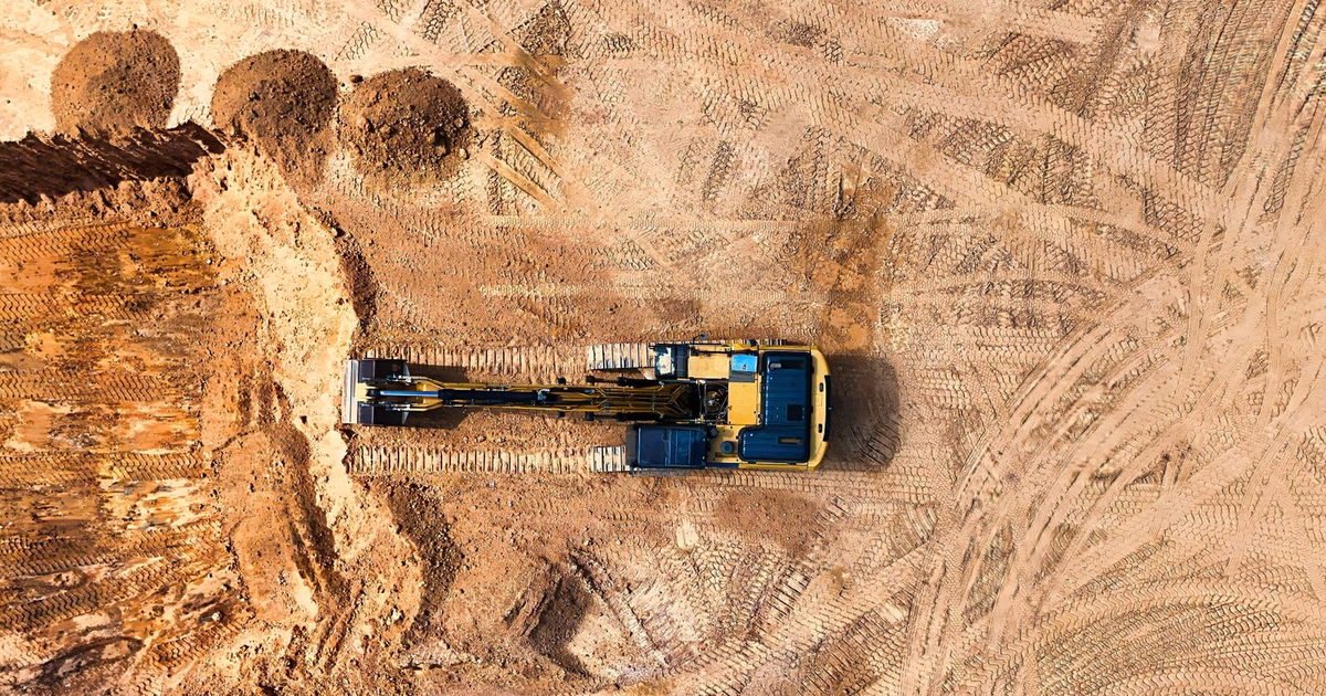
There is no single way to find out what is under a plot. A rig gives you a narrow, deep and very reliable column of information. A machine-dug pit gives you a shallow but wide and highly visual picture. A geophysical survey gives you broad coverage with no direct sample at all.
Choosing between them is not about which is best. It is about which question you are trying to answer, and on most Dubai sites the honest answer involves more than one method. This article sets out what each route actually reveals, where each one fails, and how they are combined in practice. It sits under our full walkthrough of the assessment process.
Key Takeaways
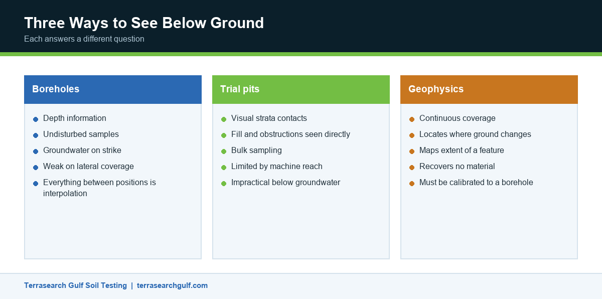
- Boreholes give depth and undisturbed samples but only describe the ground at each position.
- Trial pits give a wide, visual picture of near-surface conditions but cannot reach depth or be dug safely below groundwater.
- Geophysical methods give continuous coverage between positions and recover nothing. They interpret, they do not sample.
- On variable ground the methods are complementary. Geophysics finds where the ground changes, and boreholes tell you what it changed into.
What a Borehole Actually Tells You
A borehole is the only method that brings material back from depth in a condition a laboratory can test. That single property makes it the backbone of almost every investigation.
Advancing the hole produces a continuous log of the strata encountered, depths of each change, and groundwater on strike. In-situ testing happens inside the hole as it advances, and samples are recovered at intervals for classification, strength and chemical testing. How a rig advances a hole and what it recovers determines the quality of everything downstream.
The limitation is coverage. A borehole describes a column perhaps a hundred millimetres across. Everything between boreholes is interpolation, and on ground that changes sharply over short distances, interpolation is where the risk lives.
- Best for: depth information, undisturbed samples, groundwater, anything that must be laboratory tested.
- Weak at: lateral coverage, detecting features between positions, mapping the extent of an anomaly.
- Typical depth: from a few metres for villas to well below anticipated pile toe level for towers.
What a Trial Pit Shows That a Borehole Cannot
A trial pit is a machine-excavated hole, usually a few metres deep, that exposes the ground as a face you can look at and photograph. Its value is visual and it is considerable.
Strata boundaries that appear as a line on a borehole log are visible in a pit as a real contact, with its true dip and its true irregularity. Fill can be seen for what it is, including what was buried in it. Obstructions, old foundations and services are found directly rather than inferred. Bulk samples of a size no borehole can recover are straightforward to take.
The constraints are equally clear. Depth is limited by the excavator’s reach and by stability. Pits cannot be worked safely below groundwater without support, which rules them out across much of coastal Dubai below the first few metres. And a pit disturbs the ground it exposes, so it cannot provide undisturbed samples from its base.
- Best for: near-surface conditions, fill assessment, obstructions, bulk sampling, visual confirmation of a boundary.
- Weak at: depth, anything below groundwater, undisturbed sampling.
- Typical depth: shallow, governed by machine reach and face stability.
What Geophysics Adds, and What It Does Not
Geophysical methods measure a physical property of the ground from the surface and infer structure from it. Seismic methods measure how fast energy travels, resistivity methods measure how readily current passes, and ground-penetrating radar measures reflections from buried interfaces.
Their strength is continuity. Where boreholes give you points, geophysics gives you a section across the whole line between them. That makes it very good at finding where something changes: the top of rock rising and falling, a solution feature, an old channel, a buried structure.
Their weakness is that they recover nothing. A geophysical section is an interpretation of a measured property, and the same measurement can often be explained by more than one ground model. Without boreholes to calibrate it, a survey tells you that the ground changes without telling you what it changed into. Our note on surveying what lies beneath from the surface covers where it fits in a programme.
- Best for: continuous coverage, locating anomalies, mapping the extent of a feature found in a borehole.
- Weak at: absolute values, material identification, anything requiring a sample.
- Always calibrate against at least one intrusive position.
How the Methods Combine on a Dubai Site
On a straightforward plot with consistent ground, boreholes plus in-situ testing are sufficient and anything more is spend without return.
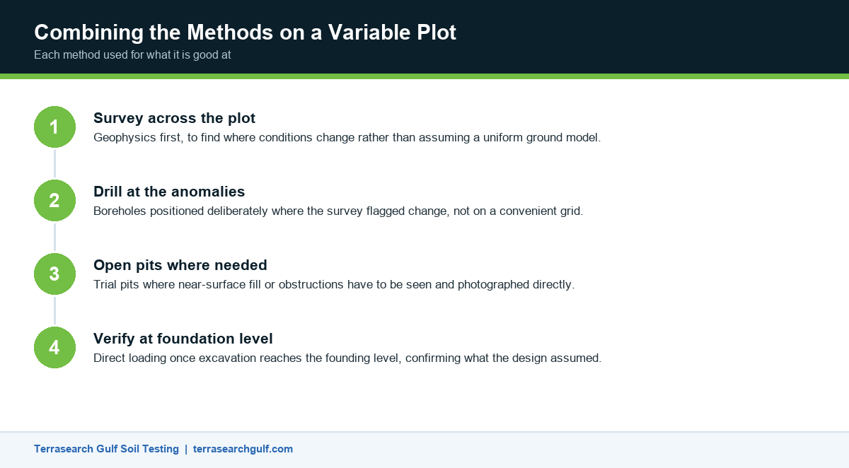
The picture changes where the desk study suggests variability. A common and effective sequence runs geophysics first across the plot to find where conditions change, then boreholes positioned deliberately at the anomalies rather than on a convenient grid, then trial pits where near-surface fill or obstructions need to be seen directly. Each method is being used for what it is good at.
In-situ testing threads through all of it. The hammer-and-sampler method behind N values runs inside the boreholes, the cone method that logs resistance continuously fills the gaps between them where the ground is soft enough to penetrate, and proving bearing pressure at shallow depth verifies the result at foundation level once excavation reaches it.
Where levels and features above ground also matter, mapping levels and features before design runs alongside rather than instead of the intrusive work.
Ground Conditions That Drive the Choice in Dubai
Four local conditions push the decision more than anything else.
High groundwater across coastal areas rules out deep trial pits and makes borehole technique and groundwater recording more important. Reclaimed land brings fill of uncertain age and composition, where pits and geophysics together are far more informative than boreholes alone. Variable rockhead, where the top of competent rock rises and falls sharply, is the classic case for geophysics to map the surface and boreholes to confirm what it is. And coastal salt flat deposits are weak, variable and chemically aggressive, so they need both physical characterisation and a chemical suite.
That last point is easy to underestimate. Ground aggression in the Gulf drives the substructure concrete specification, and the chemical checks for buried concrete belong on the schedule from the outset rather than as an afterthought.
Choosing a Method Without Over-Specifying
The commercial failure mode runs in both directions. Under-specifying means boreholes alone on ground that changes between them, and the first anyone hears of the variation is when excavation exposes it. Over-specifying means a geophysical survey commissioned on a uniform plot where boreholes would have answered the question at a fraction of the cost.
A short conversation at scoping stage usually settles it. What does the designer need to prove? What does the desk study suggest about variability? How sensitive is the structure to differential conditions? Answer those three and the method selection follows. Scope, stages and report contents sets out how that conversation is structured.
If you are still choosing a provider, check that whoever proposes a method can also execute it. Some firms subcontract geophysics and then interpret it without the person who acquired the data, which is where soft interpretations come from. How to weigh one provider against another covers what to ask.
Frequently Asked Questions
Is geophysics a replacement for drilling?
No. Geophysical methods measure a property and infer ground structure from it; they recover no material. They should always be calibrated against at least one intrusive position, and they cannot supply samples for laboratory testing.
How deep can a trial pit go?
In practice a few metres, limited by machine reach and by the stability of the face. Below groundwater they become impractical without support, which restricts them across much of coastal Dubai.
Which method finds buried services and obstructions?
Ground-penetrating radar and electromagnetic location for the initial sweep, then trial pits to confirm visually. Boreholes are the wrong tool for this and risk striking what you are looking for.
Can I use trial pits instead of boreholes to save cost?
Only if the structure is light and the relevant ground is genuinely shallow. For anything with meaningful loading, or where groundwater is near the surface, pits cannot reach the depth the design needs.
What does a geophysical survey cost relative to drilling?
It is usually cheaper per metre of coverage and more expensive to mobilise. That economics favours it on larger plots and works against it on small ones.
Do I need undisturbed samples?
If strength or compressibility is being measured in the laboratory, yes. Disturbed samples are adequate for classification and chemical testing but will give misleading strength results.
How many positions are enough?
Enough that variation across the plot is detected rather than averaged. The number rises with plot size, expected variability and the structure’s sensitivity to differential settlement.
What is rockhead and why does it matter?
Rockhead is the top of competent rock beneath weaker overburden. Where it rises and falls sharply, a foundation may sit on rock at one corner and on loose material at another, which is exactly the condition that causes differential settlement.
Should the same company do all the methods?
It helps. When acquisition, drilling and interpretation sit in one team, the geophysical section gets calibrated against the actual logs rather than against an assumption.
When should this work be commissioned?
Early enough that results inform the foundation concept rather than confirm one already fixed. Instructed late, it becomes a compliance exercise that occasionally forces redesign. Our overview of ground assessment work covers programme timing.
Matching the Method to the Question
Boreholes, pits and geophysics are not competitors. They answer different questions, and the cost of choosing badly shows up during excavation rather than during procurement. Decide what the designer needs to prove, then pick the combination that proves it.
Terrasearch Gulf runs drilling, in-situ testing, survey work and laboratory analysis from a single accredited Dubai facility, so the interpretation is done by the people who acquired the data. Tell us about your plot and we will propose a scope that fits it.